検索
さらに詳細検索
>English
文化遺産データベース
国指定文化財等データベース
せいようしんろず
西洋鍼路図
絵画
17世紀
羊皮紙着色
2面
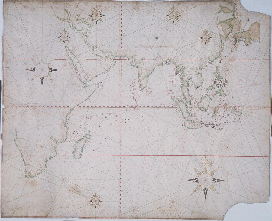
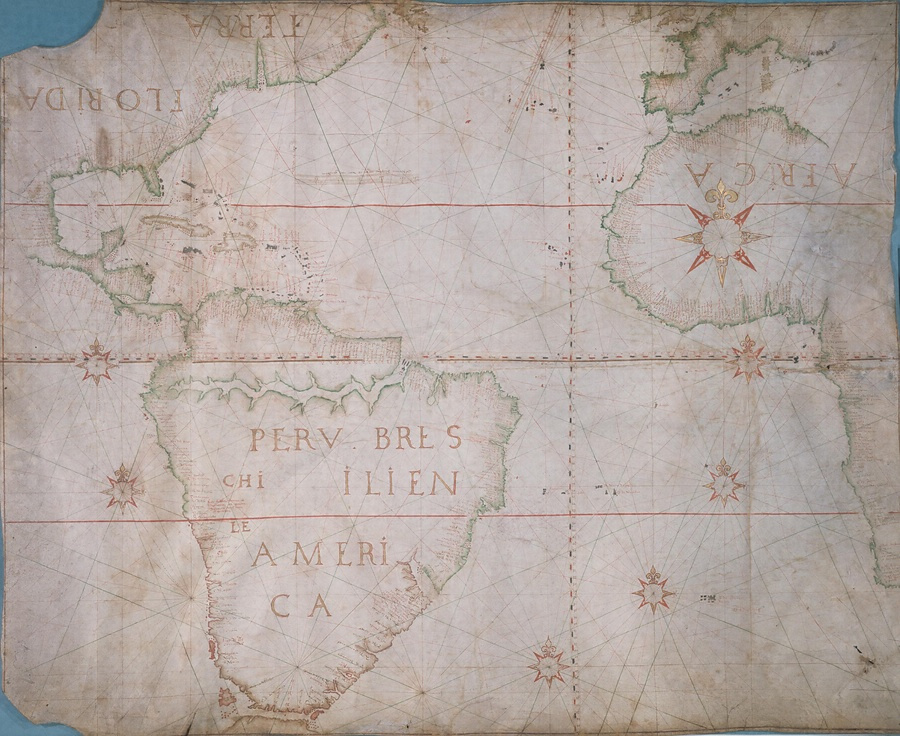
ヨーロッパ製のポルトラーノ型海図で2枚からなる。1枚は東は日本から西はインド洋まで、もう1枚はヨーロッパ・アフリカに大西洋をはさんで南北アメリカを描く。日本の形状は一部後筆で修正されており、実見に基づいて補ったものであろう。
西洋鍼路図をもっと見る
東京国立博物館をもっと見る
キーワード
ヨーロッパ / 図 / 地図 / 西洋
所蔵館のウェブサイトで見る
日本航海図〈(羊皮紙著色)/〉
日本国航海図
世界四大洲図・四十八国人物図屏風
アジア航海図
師父二童子図・西洋二武人図
ヨーロッパ図
ゼルマニヤ廓中之図
アジア図
中国図
中国風景図
染付西洋風景図皿
アジア新図
文化庁 〒602-8959 京都府京都市上京区下長者町通新町西入藪之内町85番4 メール:online@mext.go.jp
共同運営NII Powered by GETA (C) The Agency for Cultural Affairs